 |
|
Haqlet al-Heya, a cluster of Ehmej eastern extremity. Altitude 1200m.
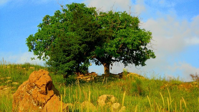
A narrow concrete path leads to an old oak tree and continues as a footpath to a high vertical isolated rock known as “Qornet-ar-Râheb” or “The Monk’s Peak, known for mysterious history with it’s numerous hidden caves – Km 0.7
A nice path leads to its top where a cross has been planted. It’s only a few minutes off trail and certainly worth the climb for an amazing panoramic view of Ehmej.
|
 |
|
Return to the footpath and in a few minutes you will arrive to a small concrete footbridge passing over the Mihal river bed. The area is known as “Ain en Nassouh” or “The Wasp’s Spring”. There is a non-flowing, non-drinkable but nonetheless nice water point at the foot of a small cliff.
|
 |
|
Follow the path eastward towards Laqlouq for approximately 15 minutes until you reach the first opening in the mountain to your right. This area is known as “Wadi al-Naznazi ” or “The valley of the dripping water”.
Leave the major trail to follow a narrow and steep footpath that winds its way along the thalweg (valley line). The gradient soon levels out and you will enter a beautiful wooded area, mostly iron-oak trees with large deciduous leaves and cork-like trunks. This is one of the five live-oak species in Lebanon that can grow very old and very tall. Rock formations are shaped by wind and rain erosion and a phenomenon known as ice-heaving. Sinkholes may be found here but are not always obvious to the eye.
“Al-Qantara” or “The Arch” is one highlight of this trail. It’s called The Arch because of the large stone slab covering the rocky passage. Amateurs of rock-climbing or bouldering will not be disappointed.
The path continues uphill and eventually flattens at the top at an old forgotten cherry orchard. This is the highest point of the itinerary. Altitude 1600m. – Km 4.7
|
|

|
|
Walk further down to Wardiyat where a larger valley originates, known as “Wadi al-Ghbâr”.
The trail follows the left flank of the Wadi, wooded at first but the greenery soon disappears as it widens to allow a downhill view of the Mihal main valley and the road to Laqlouq. A detour will take you to “Nabaat al-Ghbâr”, seeping out of the rock in the middle of the thalweg.
|
|

|
|
Walk back to the trail and hike downstream the main trail access. Passing by flowing water (depending on the season), cows and a field of wheat, you reach points C and B and the “AinNassouh” footbridge. Should you be in a hurry, go back the way you came.
If you wish to continue, you can close the loop by crossing the bridge for the short dirt road leading to an asphalt street that you must cross and keep to the right to find a steep footpath that will ascend for roughly 15 minutes.
|
|

|
|
You will find another beautiful old oak tree to your left and a flat path that leads to the old deserted village of “Bkarta”. Only the renovated St. George church still stands next to an old evergreen oak.
The place is nostalgic for its history whith large mansions, vaulted rooms and unique architecture.
The narrow path winds its way through the ruins and arrives to a dirt road leading (200m) to an asphalt road and an old stone house. The old house is a beautiful example of the century-old homes built with wooden ceilings and central pillars. Km 11.3
You have reached the end of your journey once you near the asphalt which joins the main road at a bridge. Walk roughly 50m towards Ehmej and you will find a short footpath to the left taking you back to the starting point.
|

